
100 Best: Snake River, Henry's Fork
Location: Eastern Idaho
Type of stream: Freestone river
Angling methods Fly and spinning
Species: Rainbow in upper reaches, browns and rainbows below Mesa Falls
Access Easy to moderate
Season: Varies by section, check current Idaho regulations. Supporting
Services: Last Chance
Short take: As easy and as tough as can be
Handicapped access: Yes, below Island Park Dam
Closest TU Chapter: Snake River Cutthroats
Inconsistent water flows have challenged Henry’s Fork over the years. However agreements brokered by the Henry’s Fork Foundation with an assist from TU’s Idaho Water Project have facilitated a cooperation among the Bureau of Reclamation, the Fremont-Madison Irrigation District, the Idaho Department of Fish and Game, and other stakeholders has resulted in more consistent flows which ensure that Henry’s Fork will remain one of Idaho’s premier trout streams
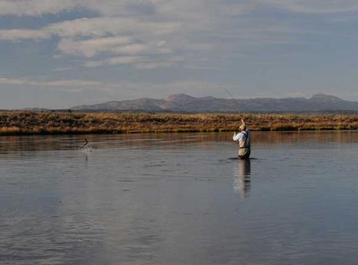
Let’s divide Henry’s Fork into four sections. Below Island Park Dam, the river cuts down between a set of low basalt bluffs for three miles in what’s known as Box Canyon. Best access is by boat, though some paths lead from the old road which swings west of US Rt. 20 between Last Chance and Island Park. Rainbows of 20 inches plus are frequently hung in these stretches on big nymphs—rubberlegs, stones, Bitch Creek are all good—and once in a while on dries.
Emerging from the Box about a mile upstream of Island Park, the gradient lessens. Here begins the 13-mile “Ranch” run of river that can be as stingy as Silver Creek or as generous as the Snake’s South Fork is wont to be. The upper and lower sections that flow through Harriman State Park resemble a spring creek, dotted here and there with islands and adjacent shoals Aquatic grasses undulate with the current.
Downstream from Osborne Bridge, the river flows through broad grasslands and just above Pinehaven begins to enter a canyon. Increasingly the river bed becomes rocky. Low bluffs grow as the river flows downstream. Anglers traveling by shanks mare can enter the river from a number of spots along US 20 or on the east side of the river from forest service tracks branching from Mesa Falls Road Wood Road 16 provide walk-in access to much of the eastern side of the river. Below Mesa Falls, the river breaks free of its caldera, ambles through a pair of small impoundments, and takes on the broad riffle run character of its sibling the South Fork of the Snake which it joins downstream from Rexford.

