In Teton County, the Snake River mainstem is a highly dynamic river that can experience flows ranging from 300 to 30,000 cfs in a single season. In and around the Snake River levee system, the Snake River is especially dynamic due to heightened erosive forces from the levee’s straightening and channelization and lack of access to its floodplain. This has led to a decrease in diversity of fish habitat in the mainstem Snake River as well as increased erosion and land loss in areas without levee protection or riprap. Agency and nonprofit partners in the County are concerned about increased use of riprap for bank protection in the Snake River headwaters, including some reaches protected by Wild and Scenic designation, without exploring alternatives to riprap such as bioengineering. At the Lower Snake River Ranch, project partners are seeking to address approximately 1,000 feet of heavily eroding bank along the Snake River mainstem and another 2,000 feet along one of its side channels. In addition to increasing habitat complexity, diversity, and quality at this location, as well as reducing sedimentation from eroding banks, the project will be a unique and highly visible opportunity to showcase alternatives to riprap when stabilizing banks, the concurrent habitat benefits of these alternatives, and best management practices for riparian buffers and cattle grazing.
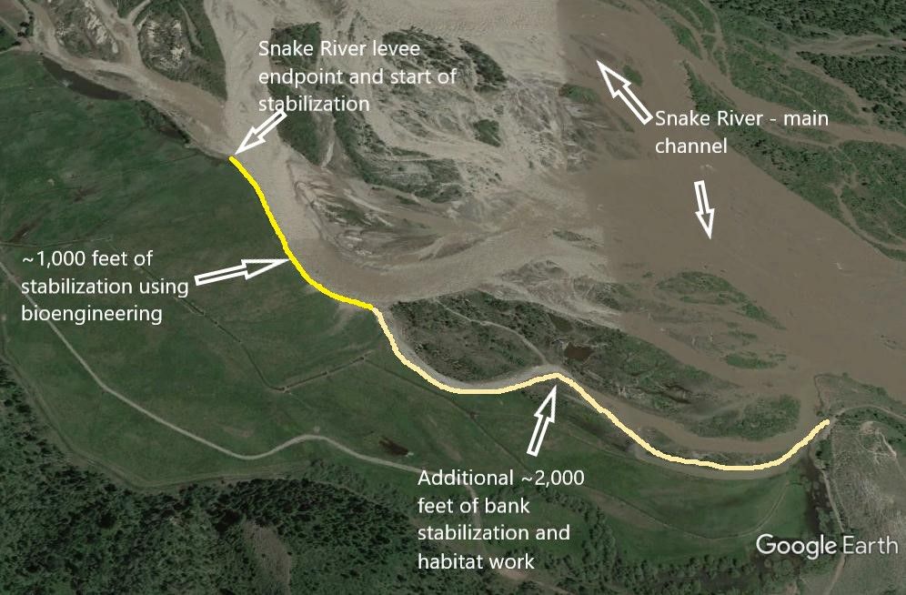
The Lower Snake River Ranch Bank Stabilization and Fish Habitat Project area is located on the Snake River Ranch’s property along the Snake River, downstream of Wilson and upstream of South Park, near Munger Mountain. The pasture adjacent to the Snake River at this location was used for cattle grazing, and although there was currently riparian fencing installed along the bank, there was little to no woody riparian vegetation established. The Ranch had experienced significant bank erosion and land loss at this location, downstream of the river-right terminus of the Snake River levee, which demonstrates the river’s highly variable range of flows and geomorphic dynamism. From 2009-2017, approximately 180 feet of bank and irrigated pastureland were lost, or about 22.5 ft/year. This eroded bank is not along the main channel of the Snake River, however, as recently as the summer of 2017, the main channel was along this bank, and accelerated rates of bank erosion were observed. There was about 1,000 feet of exposed, vertical, actively eroding banks along the Snake River, and an additional 2,000 feet of eroding banks in a smaller side channel of the Snake River behind a vegetated island (which includes a small portion of public land). Protecting these banks by adding length to the Snake River levee is not allowed by the US Army Corps of Engineers at this site. In addition, there was very little cover or rearing habitat for Snake River cutthroat trout in this section of the river.
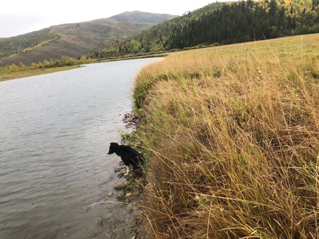
TU and project partners collaborated on this project to address bank erosion, land loss, and lack of quality fish habitat within the project area, by using “bioengineered” bank treatments that have been modeled to withstand a wide range of flows and forces and are expected to remain robust over time.
Project goals included:
1: Stabilizing banks in the project area using bioengineering techniques to minimize land loss and reduce downstream sediment contributions for the benefit of water quality.
2: Improving local habitat conditions for all life stages of Snake River cutthroat trout and other native fish in the project area by addressing bank erosion and a lack of in-stream/overhead cover and slower backwater areas.
3: Showcasing the benefits and effectiveness of bioengineering techniques for bank stabilization and fisheries along a highly visible reach of the Snake River.
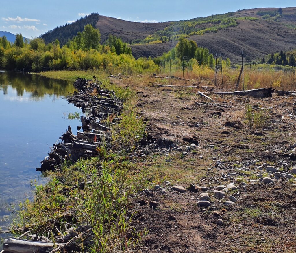
Installed vegetation barrier for stabilization and cover for aquatic species, along with riparian fencing to promote willow growth, September 2025. Credit: Kole Stewart
Project partners to date include Jackson Hole Trout Unlimited, Snake River Ranch, Teton Conservation District, and Wyoming Game & Fish Department
